Market
ShoreVize is a concept-stage venture. The market analysis below reflects research into the commercial opportunity — not confirmed customers, pilots, or signed revenue.
Coastal Risk & Economic Exposure
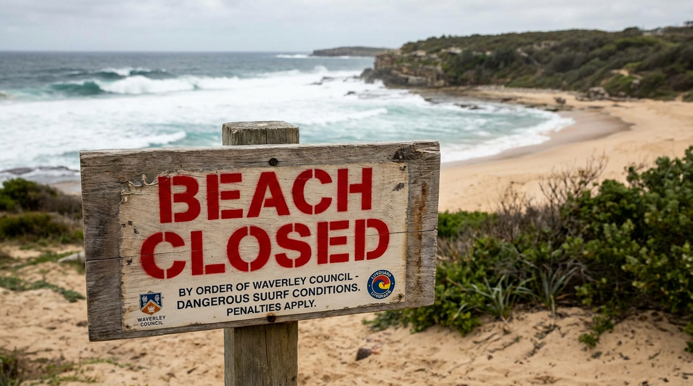
Coastal communities and resort operators face recurring economic disruption from marine hazard events, including shark incidents, rip-current emergencies, and precautionary beach closures. In Australia alone, the documented impact of shark-related coastal disruption since 2014 exceeds AU$170 million in private tourism losses, with an additional AU$121 million in public mitigation spending by NSW, WA, and Queensland governments—bringing the combined economic footprint to well over AU$290 million.
These losses are not evenly distributed. Individual operators in affected corridors often absorb the sharpest hits: during the 2014–2016 Ballina cluster, surf retail sales reportedly fell by 75–90%, one accommodation provider reported bookings down 30%, and three local surf shops closed entirely. The 2018 Whitsundays incidents produced a reported AU$61 million regional tourism impact, including a 6% drop in international visitors within a single year.
Beach closures and hazard alerts compound the damage. Following shark incidents, documented beach closures have averaged roughly 43 hours, with losses flowing across hotels and short-term rentals, surf schools and water sports operators, restaurants and retail, and event permits and coastal concessions. At the same time, rip currents remain one of the most persistent surf-zone safety threats at busy beaches, forcing lifeguards and councils to make difficult decisions with limited real-time visibility into changing wave and current conditions.
Even precautionary shutdowns—independent of confirmed incidents—carry measurable economic consequences. The January 2026 NSW cluster of four attacks in 48 hours triggered closures across dozens of east-coast beaches, with affected local government areas reporting an estimated 30% daily footfall decline.
ShoreVize is being developed as preventative coastal infrastructure designed to reduce that uncertainty. By combining offshore marine detection, in-water wave and current sensing, and future compatibility with beach webcam AI systems where available, ShoreVize is intended to give operators, councils, and lifeguards better situational awareness before closures become unavoidable.
Addressable Market Framing
ShoreVize sits at the intersection of several established coastal spend categories, including municipal coastal operations and shark‑mitigation budgets, resort safety and guest‑amenity investment, marine monitoring and environmental management programs, and coastal event and tourism infrastructure.
The market is already proven by public expenditure. Australia alone has deployed more than AU$121 million in shark‑mitigation funding across NSW, WA, and Queensland in recent years—capital that currently flows to drones, listening stations, and drumlines, each with critical operational gaps and limited continuous coverage. ShoreVize is positioned to reallocate a portion of that existing spend into permanent, lower‑cost infrastructure rather than ongoing patrol operations.
While shark incidents remain statistically rare relative to total ocean use, precautionary closures and public‑safety mandates generate persistent demand independent of incident frequency. The January 2026 NSW cluster triggered closures across dozens of beaches, with affected areas reporting an estimated 30% daily footfall decline—illustrating that the economic case for prevention can far exceed the cost of detection infrastructure.
ShoreVize’s addressable market scales with shoreline length and swimmer density, not incident count. Any patrolled beach with a defined swim corridor, measurable daily visitor volume, and an identifiable budget holder—municipal authority, resort operator, or event organizer—is a potential deployment site, regardless of whether a high‑profile incident has occurred there before.
Primary Customer Segments
Municipal Coastal Authorities
Public beach management agencies, lifeguard departments, and coastal safety divisions responsible for swimmer protection, liability management, and government‑funded mitigation programs. In addition to shark‑mitigation spending (NSW and WA alone have committed a combined AU$33 million in recent years), these agencies shoulder ongoing costs tied to rip‑current rescues, hazard signage, and precautionary closures. ShoreVize is positioned as shared infrastructure they can fund once and use across multiple risks—sharks, rip‑current awareness, and, where available, integrations with existing camera and AI monitoring assets.
Resort & Private Coastal Operators
Hotels, gated beach communities, and destination properties with defined swim zones and direct reputational exposure. For high‑occupancy coastal resorts, a single prolonged closure or high‑profile incident—whether from a shark event or a cluster of rip‑current rescues—can produce immediate revenue impact across accommodation, water sports, and on‑property experiences. ShoreVize aims to make continuous in‑water monitoring a defensible line‑item investment rather than a discretionary one, with the option to surface both shark alerts and surf‑zone risk indicators in a single view.
Surf & Marine Event Organizers
Surf competitions, open‑water swim events, and marine festivals operating at fixed coastal venues. The 2018 cancellation of the WSL Margaret River Pro following two nearby attacks cost the local economy an estimated AU$5.5 million in a single event year—the kind of exposure that makes pre‑season infrastructure investment straightforward to justify. For event organizers, a temporary ShoreVize deployment can support both shark safety and real‑time rip‑risk awareness along the competition or race course, and can complement any on‑site camera or drone coverage.
High‑Traffic Public Beaches
Tourism‑heavy waterfronts, marine parks, and popular gathering beaches in high‑incident corridors. WA and NSW account for a majority of recorded Australian shark incidents in recent years, and many of the same beaches see frequent rip‑current rescues. That concentrates risk—and ShoreVize’s addressable market—along well‑defined coastlines where lifeguards, local governments, and, in some cases, webcam‑AI operators are already actively seeking better coastal intelligence.
ShoreVize is designed for defined shoreline zones with consistent daily usage, recurring rip‑current and marine‑presence risk, and measurable economic value per protected swim corridor.
Why Existing Solutions Fall Short
Coastal authorities currently rely on a patchwork of tools, none of which provide continuous, real-time awareness of untagged large marine life across the full window that people are in the water. Each tool covers a narrow slice of the problem and leaves the core detection gap largely untouched.
Acoustic listening stations
These systems only detect previously tagged animals, which means they can never see the majority of sharks and other large marine life moving through a swim zone. Even NSW reporting confirms that only a small proportion of potentially dangerous sharks carry tags at any time, leaving most animals effectively invisible to the network. In practice, the result is an impressive-looking infrastructure map that still functions as a selective, partial early‑warning system.
Aerial drones and helicopters
Aircraft offer valuable situational awareness, but only in short, fragile windows. They depend on clear weather, cannot safely operate at night, and require trained pilots to be on hand for each flight. Even when deployed, they provide snapshots in time rather than a persistent sensing layer—there is no coverage between sorties, and nothing approaching true “always‑on” monitoring of the nearshore environment.
Drumlines and net barriers
Legacy physical interventions face growing environmental and political opposition due to bycatch, habitat disruption, and broader ecological impact. They are fixed in placement, cannot adapt to shifting sandbars or surf zones, and require daily fuel‑burning patrol vessels for deployment, checking, and maintenance. This makes them both operationally expensive and increasingly misaligned with conservation and emissions priorities.
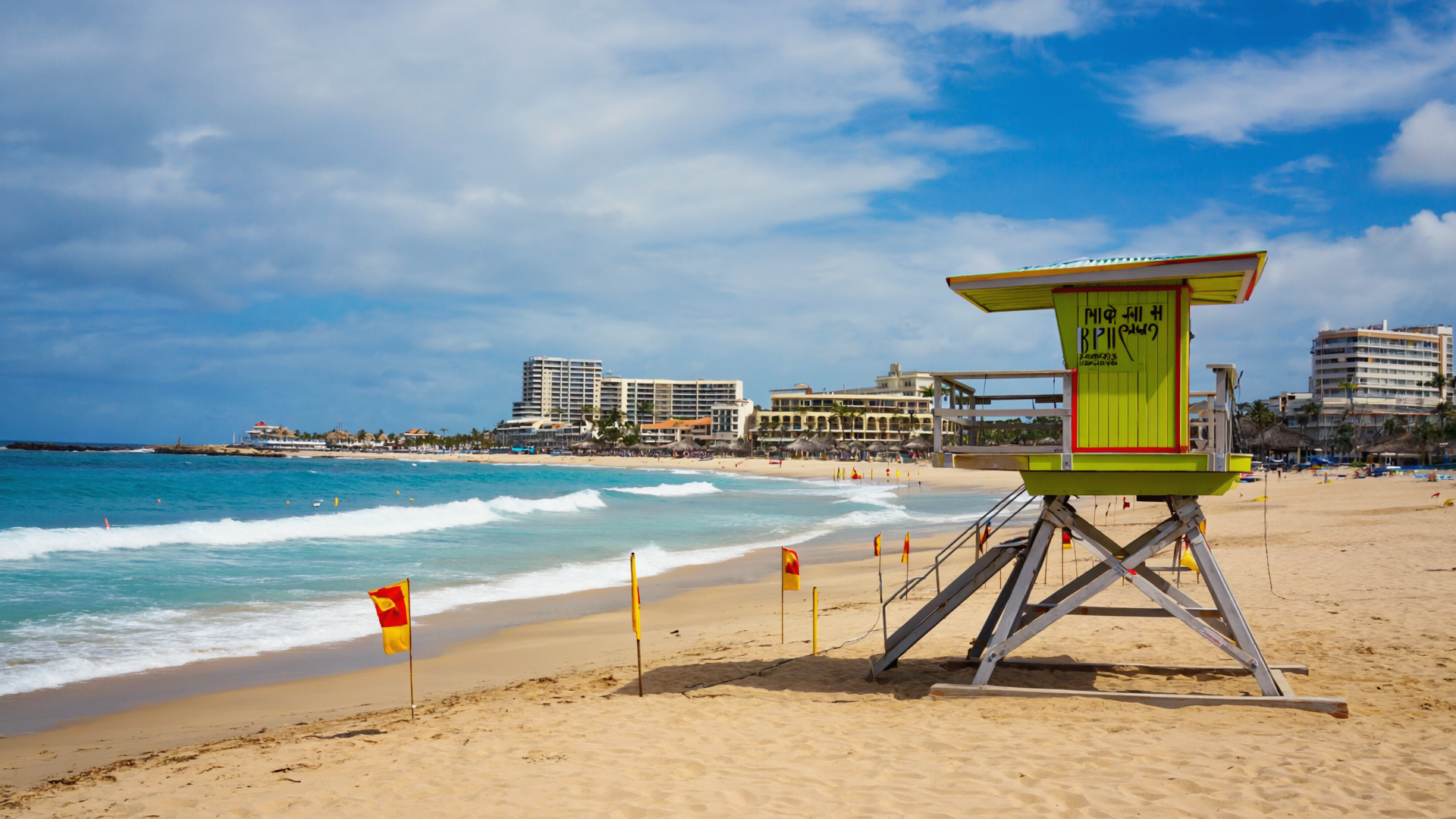
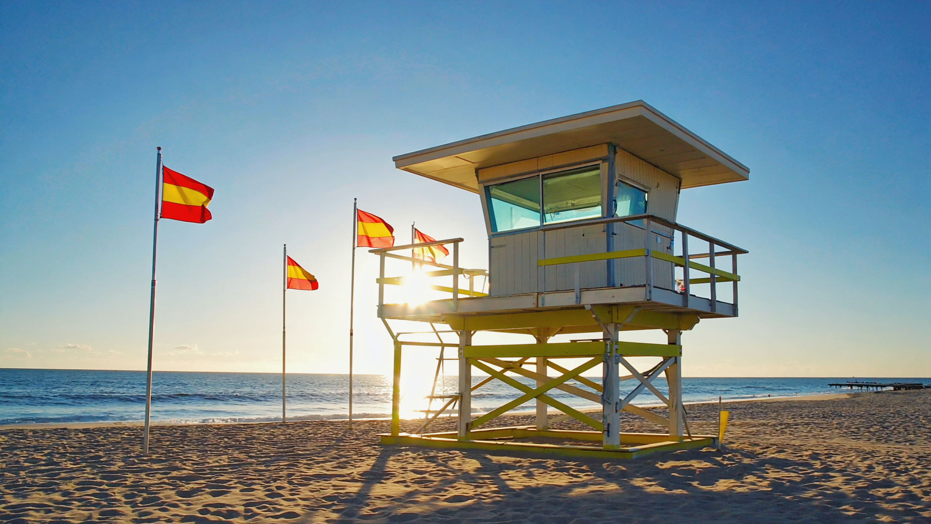
Visual patrol and lifeguards
Lifeguards remain the last, critical line of defense—but their tools are limited. Visual patrols are inherently reactive, constrained by surface visibility, wave conditions, crowding, and the distance they can realistically scan from shore or tower. They provide no subsurface or offshore detection capability and no way to “see” under or beyond the breaking waves before a threat enters the flagged swim zone.
Webcam and AI video monitoring
Fixed beach webcams and AI models can help detect people in distress, flags, or surface‑level marine presence, but they are fundamentally limited to what the camera can see. They do not capture in‑water physical conditions like wave period, current strength, or subsurface activity, and their field of view is often narrowed by glare, chop, or crowd density. On their own, they cannot provide the kind of under‑the‑surface, offshore detection that lifeguards and councils need to make proactive decisions.
Despite more than AU$121 million in combined government mitigation spending across NSW, WA, and Queensland in recent years, the January 2026 NSW cluster of four attacks in 48 hours underscored the gap: even well‑funded programs still leave most swim zones effectively unmonitored for untagged animals during normal beach hours.
ShoreVize introduces a permanent, shore‑controlled detection layer designed to close those gaps. Rather than relying on intermittent patrols, tag‑dependent systems, or surface‑only video feeds, ShoreVize focuses on detecting untagged marine life continuously within defined swim corridors, operating through darkness and poor weather, requiring no daily fuel‑burning vessel runs, and delivering real‑time, zone‑specific alerts directly to lifeguards, councils, and operators—while remaining compatible with existing camera and AI systems where they already exist.
Business Model Hypothesis
ShoreVize is still evaluating the most realistic commercial path. The current hypothesis is a five-layer model:
Geographic Focus
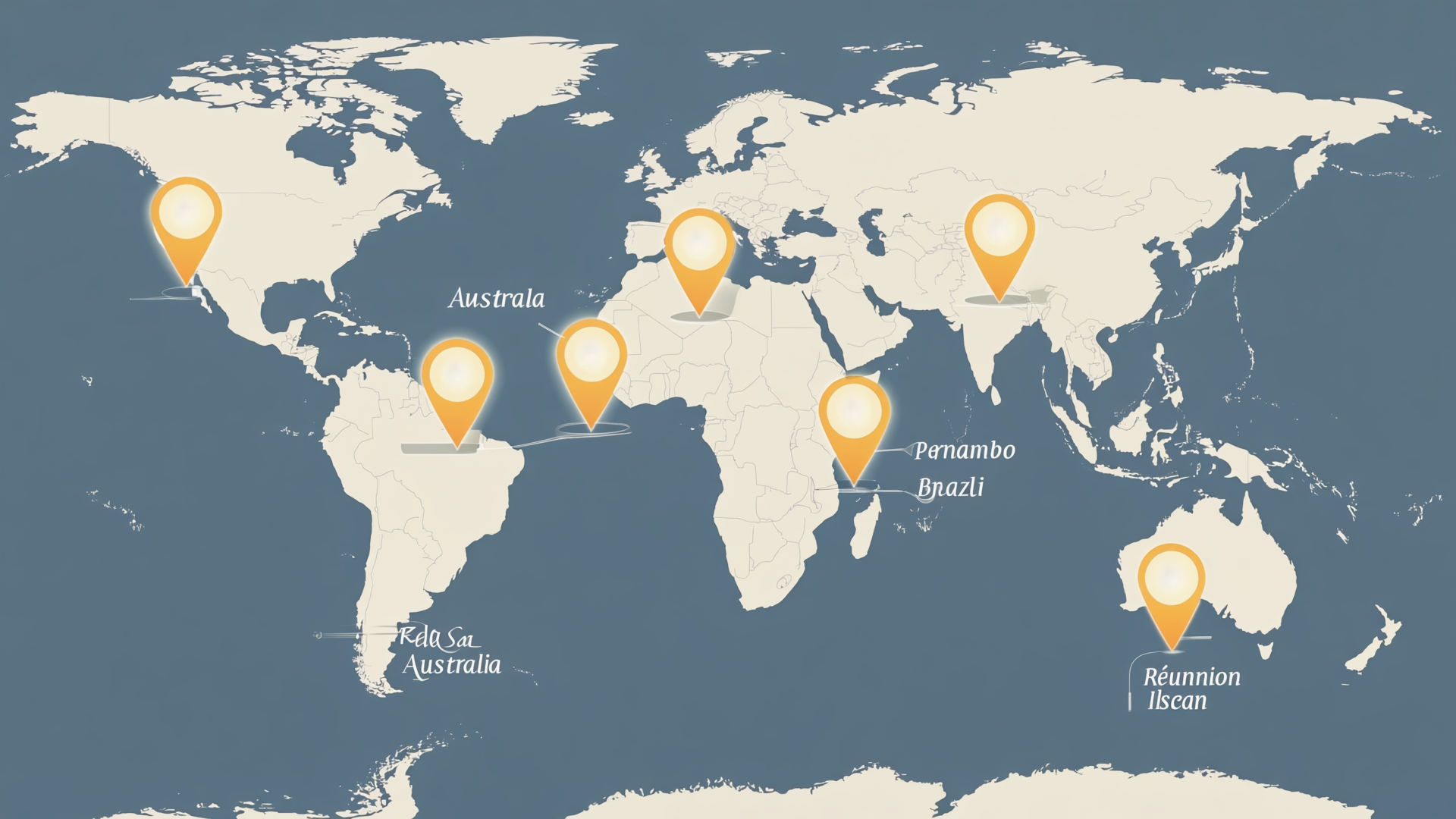
ShoreVize’s initial target regions are selected for a combination of documented shark‑incident history, recurring surf‑zone risk, established mitigation budgets, and high swimmer density—the mix of conditions that makes the case for continuous coastal detection infrastructure most immediate.
Australia — East & West Coast
NSW and WA account for a large majority of recorded Australian shark incidents in recent years, with 95 of 125 verified cases from 2021–2025 concentrated along these two coastlines. Governments have already committed more than AU$33 million in recent shark‑mitigation spending, and the January 2026 NSW cluster—four attacks in 48 hours—triggered fresh emergency funding and renewed public pressure for better continuous monitoring. These same coastlines also feature high‑traffic surf beaches where rip currents are a constant operational hazard, making Australia ShoreVize’s strongest launch corridor for combined shark and surf‑zone risk awareness.
Initial stakeholder discovery has included a conversation with surf lifesaving leadership at Dee Why Beach, NSW—a representative high‑traffic surf beach where the primary surf zone sits roughly 20–50 m from shore. At that beach profile, ShoreVize buoys would likely sit farther offshore while also supporting wave and current sensing across the protected area. This is early directional input, not a pilot commitment or letter of intent.
Florida — Atlantic Coast
Florida combines some of the highest shark‑encounter volumes in the United States with dense year‑round beach usage, lifeguarded municipal beaches, and frequent rip‑current incidents. That makes it a strong U.S. entry market—not only for direct municipal and resort sales, but also for future compatibility with NOAA, coastal observing programs, and camera‑based beach safety systems already used along parts of the coast.
Brazil — Pernambuco & Northeast Coast
The Recife–Pernambuco corridor is one of the highest‑density shark‑attack zones in the world, with decades of documented incidents often linked to port development and disrupted migratory behavior. High urban beach usage, recurring surf‑zone hazards, and limited existing continuous detection infrastructure make it a compelling international expansion market.
Egypt — Red Sea Resort Coastline
Concentrated dive and swim tourism along managed resort coastlines creates defined, high‑value swim zones with clear operators and infrastructure budgets. Incidents in this region have previously triggered international media coverage and rapid resort‑level fallout, while strong currents and open‑water recreation add a broader safety case beyond shark exposure alone. That combination makes the Red Sea coastline well suited to ShoreVize’s resort‑amenity model.
Réunion Island
Réunion represents one of the clearest examples of long‑term shark‑related coastal economic damage, with 30 attacks between 2011 and 2019—11 of them fatal—alongside prolonged beach closures and restrictions that severely impacted tourism and ocean recreation. It remains a reference case for the cost of unmanaged coastal risk and a strong example of where continuous monitoring infrastructure could carry both safety and economic value.
South Africa — KwaZulu‑Natal & Western Cape
High‑energy surf beaches, active shark‑management programs, and a mature coastal tourism economy create both operational need and institutional readiness. Existing shark net programs also face growing environmental opposition, opening a substitution opportunity for lower‑impact monitoring infrastructure that can address both marine presence and surf‑zone hazard awareness over time.

Market Validation Signals
The market for continuous coastal monitoring infrastructure is not speculative—it is already being funded by governments, councils, and operators responding to demonstrated safety and economic need.
Government spending confirms willingness to pay
NSW, WA, and Queensland have collectively committed more than AU$121 million to shark mitigation programs in recent years, with WA alone allocating AU$17.3 million in a single budget year (2024–25). This spending exists independent of ShoreVize; it represents an active, recurring budget line that current solutions—drones, listening stations, nets, and drumlines—are already drawing from.
Incidents are accelerating public and political pressure
The January 2026 NSW cluster triggered emergency funding commitments and renewed calls for better, truly continuous monitoring infrastructure, not just more patrols. Industry estimates of roughly AU$100 million in lost tourism revenue across Australia in 2025 alone make preventative infrastructure straightforward to justify when weighed against the cost of inaction and repeated closures.
Operators are already absorbing the cost of inadequate detection
Documented operator-level losses—surf retail sales down 75–90% during local incident clusters, accommodation bookings down by around 30%, and major surf events cancelled outright—demonstrate that the economic exposure is both real and concentrated among exactly the customer groups ShoreVize serves: councils, resorts, and coastal event organizers.
Webcam and rip-current systems validate demand for continuous data
Beach webcam networks and emerging AI tools for rip‑current and hazard detection are already attracting investment from councils and safety programs, proving that decision‑makers value continuous, real‑time data about what is happening at their beaches. But these systems are limited to what the camera can see at the surface; they do not capture sub‑surface conditions, offshore marine presence, or the physical wave and current data needed to understand how risk is evolving in the water itself. Their growth is a strong validation signal that the next step is to add an in‑water, sensor-based layer that complements and completes this data picture.
Broader coastal infrastructure investment is growing
Global expansion of smart coastal city initiatives, rising marine tourism revenue, and a shift toward data‑driven risk management are all pushing coastal operators to treat technology-enabled shoreline infrastructure as a standard operational layer rather than a premium add‑on. From environmental monitoring buoys to connected lifeguard towers, the expectation that busy beaches will be instrumented is already taking hold.
ShoreVize enters a market where the budget already exists, the problem is publicly validated, webcam and rip‑current systems have proven the appetite for continuous coastal data, and current solutions have demonstrably failed to close the core detection gap for untagged marine life in active swim zones.
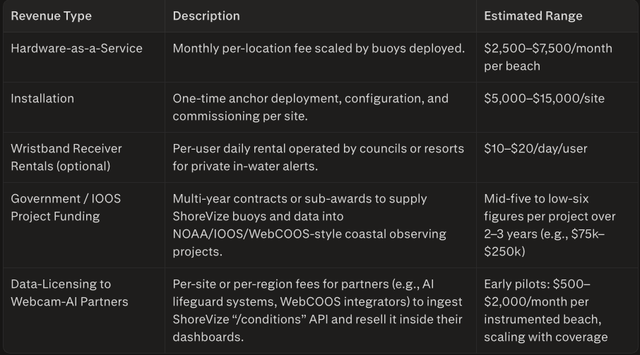
Example resort case: 50 receivers at 60% annual occupancy at $15/day ≈ $165,000 in annual receiver revenue per location—enough to cover or offset the HaaS cost entirely. The model creates built‑in switching costs: once anchor stations are moored, the infrastructure stays. Operators pay for sensors, service, and monitoring—not repeated mobilization.
In parallel, ShoreVize may also generate project‑based revenue from government and IOOS‑style coastal observing programs, and data‑licensing revenue by supplying its “/conditions” API to webcam‑AI platforms that ingest in‑water data into their dashboards. These additional streams are treated as medium‑term upside and distribution leverage, not assumptions for core early‑stage revenue.
These figures are early‑stage hypotheses for business model validation, not confirmed pricing.